Mapping Spatio-temporal Groundwater Storage Changes in Memphis Aquifer: Integration of GRACE satellite, Ground-based Estimates and Hydrologic Modeling approach
Title: GRACE Project
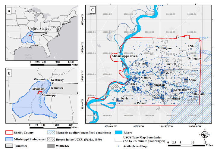
Water resource management requires better understanding of trend and seasonality of groundwater that has historically relied on a network of well levels or hydrological models. The Memphis aquifer is the main source for public supply water in western Tennessee; however, spatio-temporal mapping of groundwater in this region is lacking. NASA’s Gravity Recovery and Climate Experiment (GRACE) has been providing a powerful data source for large scale groundwater assessments although its native spatial resolution (1° by 1°) has been incompatible for local to regional scale water management purpose. This proposal aims to downscaling GRACE-derived groundwater storage (GWS) at a target resolution of 0.25° by 0.25° from January 2003 to December 2016 in Shelby County, Tennessee.
Youngsang Kwon
Associate Professor
His research interest focuses on the application of geospatial methods to understand fundamental ecological and environmental processes that regulate biodiversity, species distribution, and abundances.