Youngsang Kwon

Youngsang Kwon

Associate Professor

Earth Sciences, University of Memphis

Biography

Youngsang Kwon is an Associate Professor of Earth Sciences at the University of Memphis. Grounded in the theoretical framework of biogeography, his work primarily deals with the development of spatially explicit models for enriching our understanding of forest community patterns and responses to changing environments (natural and anthropogenic) in the multi-scale contexts (spatial and temporal) of landscapes.

Interests

  • Biogeography
  • GIS/RS/Python/R
  • Species distribution models (SDMs)
  • Forest ecology/ Forest carbon dynamics
  • Forest Inventory and Analysis

Education

  • PhD in Geography, 2012

    The State University of New York at Buffalo

  • MS in Environmental Studies, 2004

    Seoul National University

  • BSc in Forest Resources and Environmental Science, 2001

    Korea University
Experience


Associate Professor

University of Memphis

Sep 2020 – Present Memphis, TN

Research area includes:

  • Spatial Modeling (Spatial Distribution Modeling)
  • GIS/RS
  • Data Science (open-source)


Assistant Professor

University of Memphis

Sep 2013 – Aug 2020 Memphis, TN
Taught biogeography/ GIS/RS and Python Programming.


Visiting Assistant Professor

University of Delaware

Sep 2011 – Aug 2013 Delaware, DE
Taught GIS/RS and Python Programming.

Projects

Ripiraian corridor inventory using NAIP & LiDAR

Improved remote-sensing imagery techniques to identify riparian corridor characteristics in headwater streams and inventory wetlands, lakes, and permanent streams in West Tennessee.

Integrative data-driven modeling of species interactions on tree growth and migration

Biogeographic understanding of the effect of species interactions on tree growth and translate that mechanistic knowledge into predicting species range dynamics.

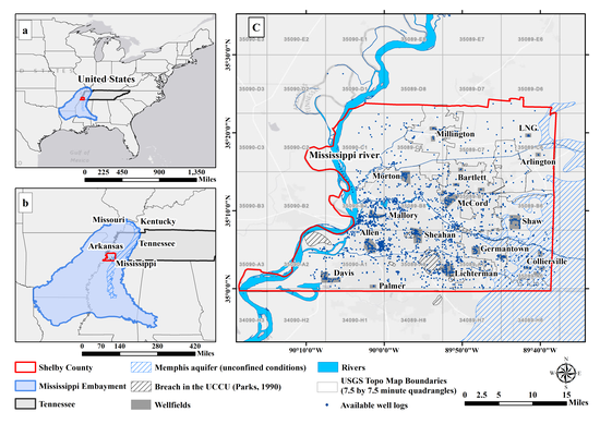
Mapping Spatio-temporal Groundwater Storage Changes in Memphis Aquifer: Integration of GRACE satellite, Ground-based Estimates and Hydrologic Modeling approach

Title: GRACE Project Water resource management requires better understanding of trend and seasonality of groundwater that has historically relied on a network of well levels or hydrological models. The Memphis aquifer is the main source for public supply water in western Tennessee; however, spatio-temporal mapping of groundwater in this region is lacking.

Recent Publications

Quickly discover relevant content by filtering publications.

Contact

  • 901 678 2979
  • 109 Johnson Hall, Memphis, TN 38152
  • Enter Johnson Hall Building and take the stairs to Office 223 on Floor 2
  • Office hours: Tuesday/Thursday 11:00 to 13:00
    or upon email request
  • kclick